exclusivetuscany.com
Map of Tuscany
Cities, sub-regions, hilltop towns & driving distances — a printable travel guide
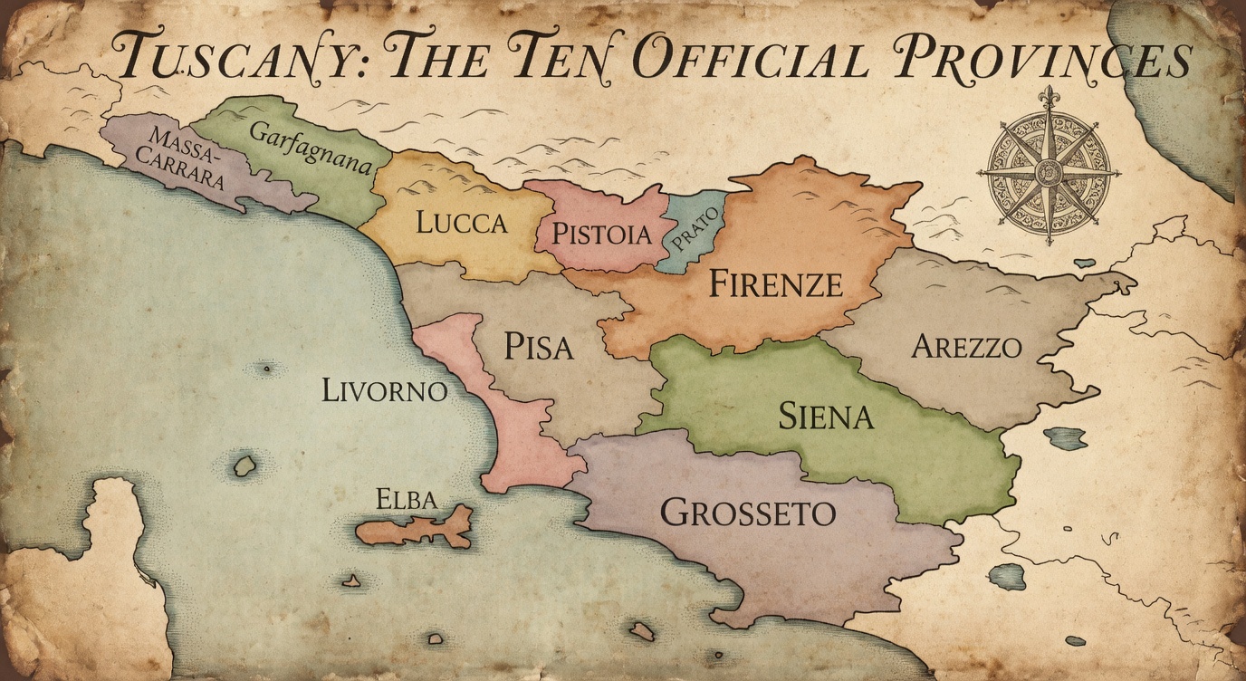
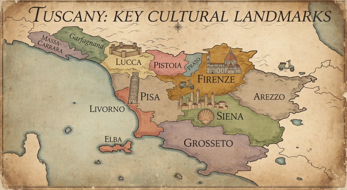
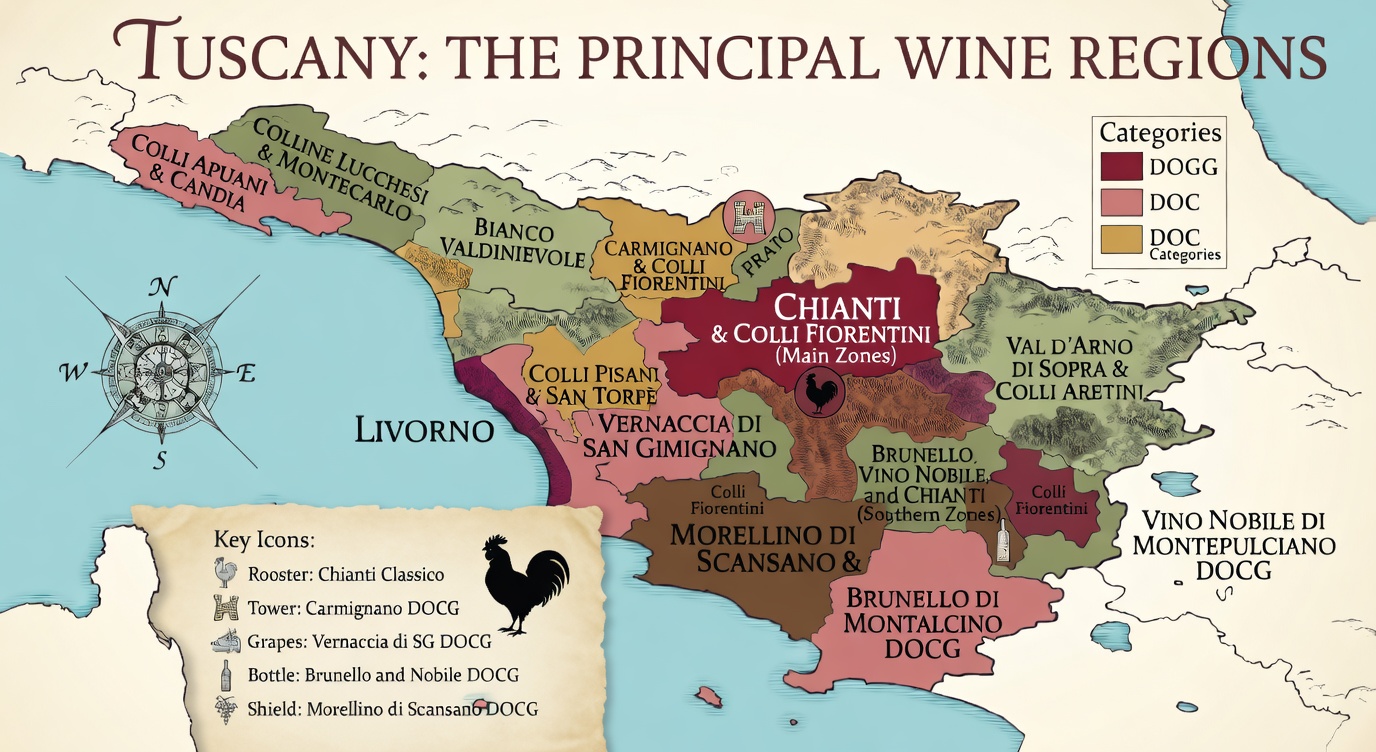
Tuscany at a glance
| Area | Landscape | Best for | Anchor town | Note |
|---|---|---|---|---|
| Chianti | Vine terraces, olive groves, stone farmhouses | Wine touring, Florence & Siena day trips, first visits | Greve in Chianti | Most villas; best all-round base, Florence and Siena within an hour |
| Val d'Orcia | Rolling clay hills, cypress avenues, UNESCO landscape | Landscapes, Pienza and Brunello producers | Pienza / Montalcino | More remote; gravel-road access common; about 2 hrs from Florence |
| Maremma & Tuscan Coast | Pine forests, wetlands, sandy beaches, Etruscan hilltops | Beach + countryside, Etruscan history, hot springs | Grosseto / Castiglione della Pescaia | Countryside and beaches in one week; check how far your villa is from the sea |
| Lucca & Northwest | Flat plain, walled city, Apuan Alps, Garfagnana forest | Lucca city, Garfagnana mountains and northwest Tuscany | Lucca | 30 min from Pisa airport; villas on the plain or in the hills |
| Umbria (over the border) | Landlocked region, historic hill towns and countryside | Assisi, Orvieto, Spoleto; ideal extension to Tuscany | Perugia / Orvieto | Natural extension from a Val d'Orcia base |
Key towns by area
Chianti
- Greve in Chianti
- Panzano in Chianti
- Radda in Chianti
- Gaiole in Chianti
- Castelnuovo Berardenga
- Castellina in Chianti
Val d'Orcia
- Pienza
- Montalcino
- Bagno Vignoni
- San Quirico d'Orcia
- Castiglione d'Orcia
Maremma & Tuscan Coast
- Pitigliano
- Sorano
- Sovana
- Saturnia
- Castiglione della Pescaia
- Monte Argentario
Lucca & Northwest
- Lucca
- Barga
- Castelnuovo di Garfagnana
- Pietrasanta
- Forte dei Marmi
- Viareggio
Umbria (over the border)
- Orvieto
- Assisi
- Perugia
- Spoleto
- Gubbio
- Todi
Driving distances & times
| From | To | km | Modelled drive | Notes |
|---|---|---|---|---|
| Florence | Siena | 75 | 1 hr 15 min | Firenze–Siena connection: RA3 |
| Florence | Greve in Chianti | 30 | 35 min | Northern Chianti |
| Florence | San Gimignano | 60 | 1 hr 5 min | Allow for hilltop parking |
| Florence | Montepulciano | 110 | 1 hr 30 min | Valdichiana / Val d’Orcia border |
| Florence | Pienza | 115 | 1 hr 40 min | Val d’Orcia; route choice matters |
| Florence | Montalcino | 140 | 2 hr | Winery addresses may be outside town |
| Florence | Lucca | 80 | 1 hr 5 min | City parking differs from a rural villa |
| Florence | Pisa | 100 | 1 hr 25 min | City, airport and tower are different stops |
| Florence | Arezzo | 75 | 1 hr 5 min | Allow for historic-centre access |
| Florence | Pitigliano | 210 | 2 hr 35 min | Southern inland Maremma |
| Florence | Cortona | 105 | 1 hr 25 min | Hilltop above Valdichiana |
| Florence | Volterra | 80 | 1 hr 25 min | Etruscan hill town |
| Siena | Pienza | 70 | 1 hr 15 min | Check the chosen road and destination |
| Siena | Montalcino | 40 | 1 hr 5 min | Allow for town access |
| Siena | Montepulciano | 65 | 1 hr 10 min | Allow for hilltop parking |
Indicative OSRM driving estimates checked 22 September 2026, using central town reference points and OpenStreetMap roads. Rounded to the nearest 5 km and up to 5 minutes; no live traffic, stops, parking or walking time. Routes can differ from the shortest road. Historic-centre access may be restricted: use current directions to your chosen parking place or villa entrance.
Printing tips
- 1.Print in portrait orientation to keep the map labels readable.
- 2.Set scaling to 'Fit to page' or 100% in your print dialogue.
- 3.Check all labels and table columns in the preview before printing.
- 4.Save as PDF from your browser: File → Print → 'Save as PDF'.
- 5.Town numbers and boundary lines remain readable in black and white.
Planning your villa?
Exclusive Tuscany — a small, curated collection of private villas across Tuscany’s sub-regions. Personal enquiry only.
Practical driving notes
ZTL zones (Zona Traffico Limitato)
Historic centres (Florence, Siena, Lucca, Arezzo) are restricted-traffic zones (ZTL): park outside the walls and walk in, as entering without a permit triggers an automatic fine.
Strade bianche (white gravel roads)
Many villas, especially in the Val d’Orcia and deeper Chianti, are reached by unpaved gravel roads. A normal hire car manages them at low speed; ask for arrival instructions, as GPS can be unreliable.
Motorway key routes
Florence–Siena: RA3. A1: Florence towards Arezzo and Rome. A11: Florence towards Lucca and Pisa. A12: the western coastal corridor. Check tolls and the final exit for your destination.
Airports
Pisa (PSA) is the main airport for most villa areas and Florence (FLR) the closest for Chianti; Rome Fiumicino (FCO) suits the southern Maremma and nonstop US flights, about 2 hours 15 minutes from the Val d’Orcia.
Map boundaries: © ISTAT 2026 via geojson-italy, simplified under CC BY 4.0. Routes: OSRM / © OpenStreetMap contributors.
Return to the full guide, with the regions explained in detail.